FIRST ALERT: Brief break from rain, stormy weekend ahead
MYRTLE BEACH, SC (WMBF) - After a busy couple of days, we will get a short break from the showers and storms to end the work week. While it’s not long-lasting, any break will be a nice change of pace to let things dry out before another round of storms arrives for the upcoming weekend.
END OF THE WORK WEEK
A few areas of dense fog this morning may develop with so much leftover moisture lingering around. Keep an eye on the typical trouble spots as you step out the door this morning. The worst of the fog should remain west of the I-95 corridor this morning.
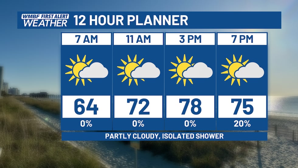
Sunshine returns for the forecast today with temperatures starting off in the lower 60s. We’ll climb throughout the day into the upper 70s on the beaches and lower 80s inland. While some models like the idea of a stray shower today, most locations should remain dry.
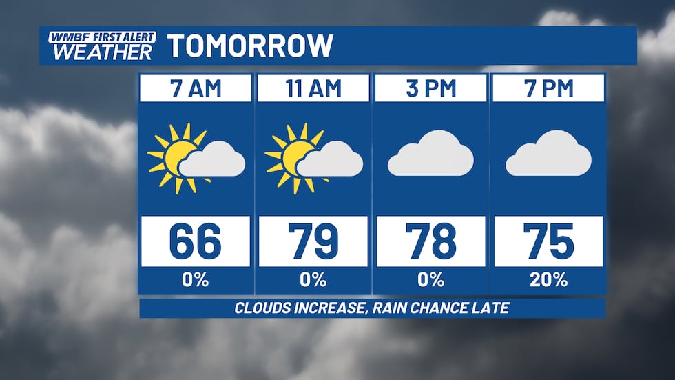
Friday will be another warm day with temperatures similar to today. The only difference will be increasing clouds throughout the day. We’ll be mostly cloudy by Friday afternoon as our next weather maker moves into the Carolinas. We’ll throw in a slight chance of a shower starting Friday evening. The worst of the rain won’t arrive until overnight and into Saturday.
SOGGY WEEKEND
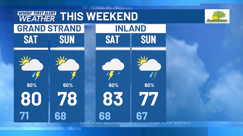
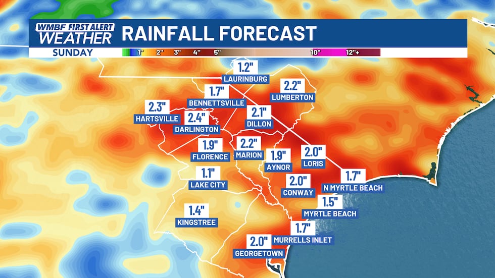
Our next storm system arrives overnight and into Saturday. A low pressure system will develop across the Carolinas early Saturday and slowly move eastward throughout the day. This means mainly cloudy skies on Saturday and Sunday with rounds of downpours.
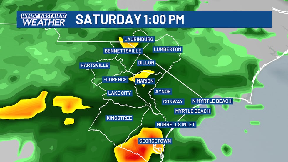
While the forecast is not a complete washout, we’ll keep the rain chances elevated throughout the weekend.
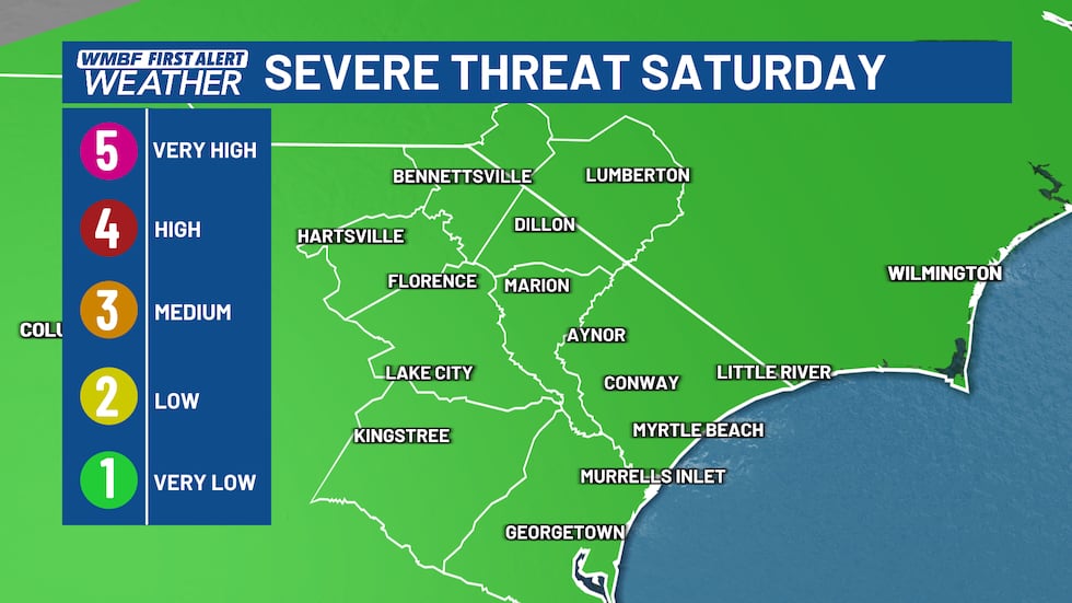
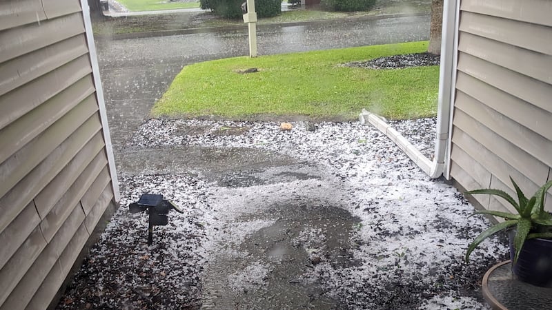
With the developing low pressure on Saturday, the Storm Prediction Center highlighted our area under a LEVEL 1 risk for a VERY LOW threat for severe weather. Thankfully, clouds and an all-day rain should help limit the severe weather potential. Given the past couple of days though, we will watch any storm closely through the weekend.
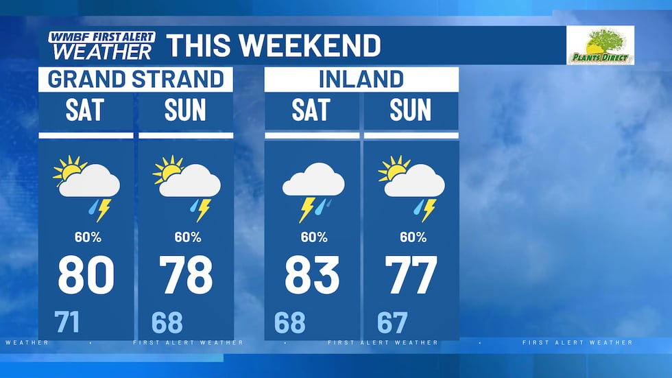
Rain chances will be at 60% for both Saturday and Sunday with temperatures in the upper 70s to lower 80s. We’ll likely pick up another 1-2″ of rain through the weekend with a few higher totals possible in locations that pick up on multiple rounds of heavier downpours.
Copyright 2024 WMBF. All rights reserved.